
Do You Need a Survey to Sell Land? What Sellers Actually Need to Know
Key Takeaways
- No state requires a survey to sell land in all cases — a valid legal description in the existing deed is typically sufficient for a standard sale, according to the National Society of Professional Surveyors
- A survey becomes effectively required when boundaries are uncertain, when the parcel is being subdivided, or when the buyer's lender demands one — in those cases, proceeding without one creates legal risk
- Many experienced cash buyers accept existing surveys or order their own — you may not need to spend money on a survey before receiving a firm offer
Do You Need a Survey to Sell Your Land?
Not always — and that surprises many landowners. No U.S. state universally requires a survey to sell land if your deed contains a valid legal description. However, a survey becomes practically necessary when boundaries are uncertain, when the parcel is being subdivided, or when your buyer's lender demands one. In most U.S. states, a land sale can legally close without a new survey. But "legally possible" and "practically wise" are different things, and there are situations where skipping a survey creates real problems. Understanding when a survey is required, when it's strongly recommended, and when you can skip it entirely will help you avoid unnecessary delays and costs.
This guide covers the types of surveys used in land transactions, when each is needed, what they cost in general terms, and how the survey question is handled differently in cash sales versus financed sales.
Is a Land Survey Legally Required to Sell Land?
In the United States, no state universally requires a new survey to sell land. What is required is a valid legal description — a written description of the property in the deed that is specific enough for a title company, attorney, or court to identify exactly which land is being conveyed, according to Cornell Law School LII.
What Is a Legal Description?
A legal description is not the same as a street address or a county tax parcel number. It is a precise written description of the property boundaries using one of three established systems:
- Metes and bounds: Describes the boundary by starting at a defined point (the "point of beginning") and tracing along each boundary line using compass bearings and distances, according to Cornell Law School LII. Common in the eastern United States, where surveys predate the federal grid system.
- Public Land Survey System (PLSS): Divides land into townships, ranges, sections, and fractions thereof. Used in most states west of Ohio, according to the U.S. Bureau of Land Management.
- Lot and block (recorded plat): Refers to a recorded subdivision map, identifying the parcel by lot number, block, and subdivision name. Common in subdivided areas.
If your deed already contains a valid legal description under one of these systems, a title company can typically close the sale without a new survey. The legal description in the deed is the controlling document, not a survey.
When Does a Legal Description Become Insufficient?
A legal description becomes problematic when:
- The description is vague, references markers that no longer exist ("to the old oak tree"), or contains internal inconsistencies
- There are gaps or overlaps in the chain of title that make the boundaries ambiguous
- Multiple parcels were merged or split without proper recorded instruments
- A neighbor's description and your description both claim the same strip of land
In any of these cases, a survey is effectively required to determine what the legal description actually covers on the ground.
When Is a Survey Required or Strongly Recommended?
While not universally mandated, a survey becomes practically necessary in several common situations.
Boundary Uncertainty
If neither the seller nor the buyer knows exactly where the property lines are — and there are no physical monuments (iron pins, concrete markers) in place — proceeding without a survey creates risk for both parties. The buyer may later discover they purchased less land than they thought, or that a fence or structure encroaches on a neighboring parcel.
If you're selling land where boundaries are unclear or contested, also see our guide on how to sell land with a lien or cloud on title, which covers boundary dispute resolution and quiet-title actions.
Subdividing a Parcel
If you're dividing a larger parcel into two or more pieces before selling, a survey is always required. The subdivision creates new legal descriptions for each new parcel, and those descriptions must be based on a licensed surveyor's measurements. The new plat must typically be recorded with the county before the subdivided parcels can be conveyed.
Lender Requirements
When a buyer is financing their purchase, the lender almost always requires a survey — or at minimum a location drawing or boundary certification — before closing. This protects the lender's collateral. The specific survey standard required depends on the loan type:
- ALTA/NSPS Land Title Survey (the most rigorous standard): typically required for commercial transactions and sometimes for rural land with complex features, according to the American Land Title Association
- Boundary survey or mortgage survey: a simpler certification that the improvements are within the property boundaries; less common on vacant land
- No survey waiver: some lenders will accept a title company's exception for survey matters in lieu of a survey, particularly on smaller residential lots in platted subdivisions
Because many vacant land sales are cash transactions, the lender-requirement issue is often moot. Cash buyers set their own survey requirements.
Title Insurance Requirements
A title insurer may require a survey if the property description raises questions the title search can't resolve. Alternatively, the insurer may issue a policy with a "survey exception" — meaning it will not cover any loss arising from facts a survey would have disclosed (like an encroachment or boundary discrepancy). If a buyer wants full survey coverage on their title policy, they'll need a current ALTA/NSPS survey.
Survey Requirement Summary
| Situation | Survey Required? |
|---|---|
| Standard cash sale with existing legal description | No — not legally required |
| Buyer financing with lender involved | Usually yes — lender will specify type |
| Subdividing land before sale | Yes — always required |
| Boundary uncertainty or disputed lines | Strongly recommended |
| ALTA title insurance without survey exception | ALTA/NSPS survey required |
| Existing survey less than 5–10 years old | Often acceptable — confirm with title company |
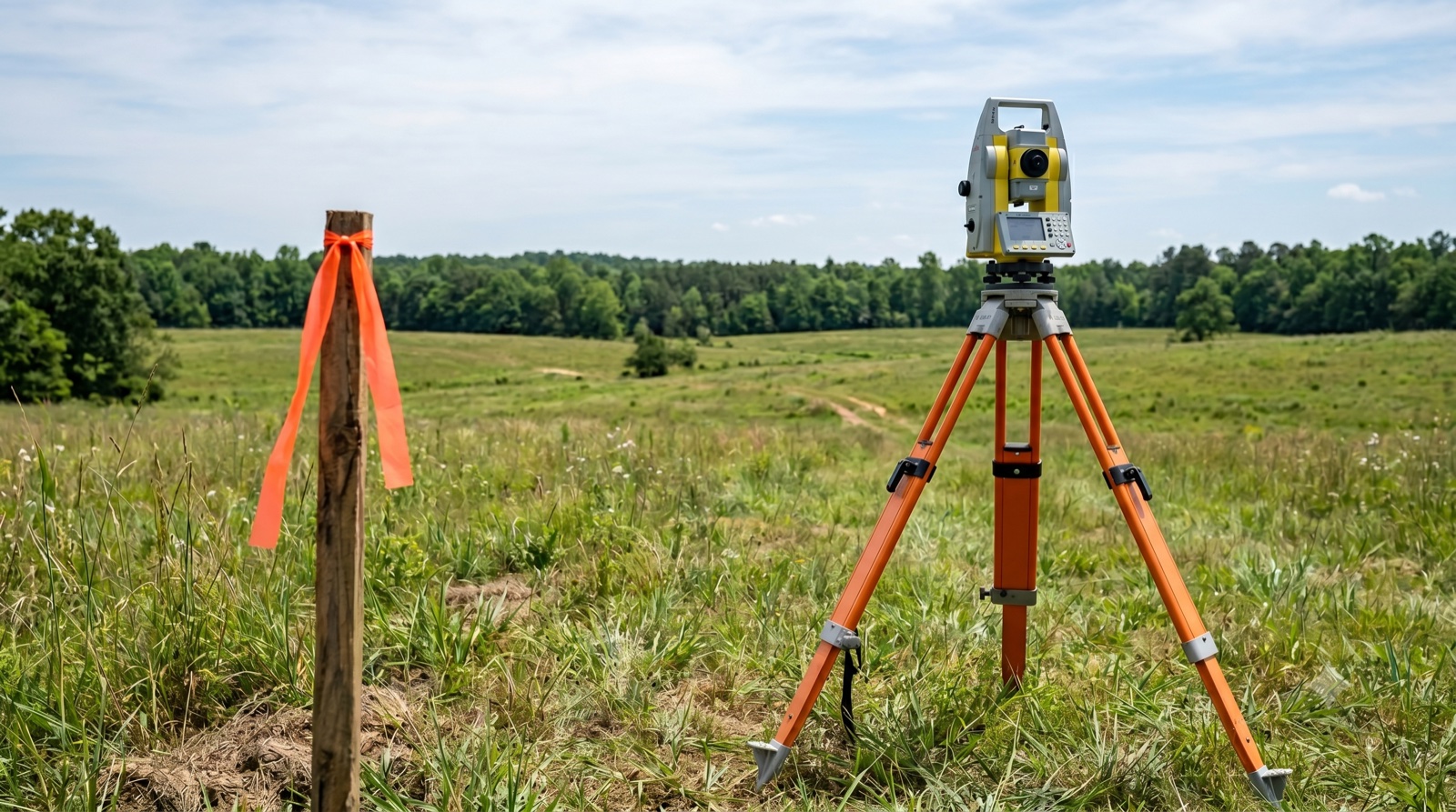
What Types of Surveys Are Used for Land Sales and What Do They Cost?
Survey costs vary significantly by state, county, parcel size, terrain, and the type of survey ordered. The following ranges are general industry estimates — actual quotes from licensed surveyors in your area may differ substantially.
Common Survey Types
Boundary survey: Locates and marks the property corners and boundary lines. Provides the most fundamental information about where the parcel begins and ends. Cost range: approximately $500–$2,500 for a typical rural parcel, though heavily wooded, large, or complex parcels can cost significantly more, according to HomeAdvisor (2024 data).
ALTA/NSPS Land Title Survey: The most comprehensive and standardized survey type, prepared to standards jointly published by the American Land Title Association and the National Society of Professional Surveyors. Shows all improvements, easements, encroachments, rights-of-way, and other matters visible on the ground. Required by most commercial title insurers and some lenders for complex transactions. Cost range: typically $2,000–$8,000+ depending on parcel size and complexity.
Topographic survey: Maps the elevation and terrain features of the land. Not typically required for a land sale but may be relevant if a buyer is assessing development potential. Cost range: varies widely by acreage and terrain complexity.
Subdivision plat: Required when dividing a parcel. Involves a full boundary survey plus the creation of a new plat map that must be reviewed by local government and recorded. Cost range: $1,500–$6,000+ depending on parcel count, local approval requirements, and jurisdiction.
Can You Use an Old Survey?
Yes — if an existing survey accurately reflects the current property boundaries, many title companies and cash buyers will accept it. Factors that make an old survey still usable:
- The legal description hasn't changed since the survey was done
- No structures have been built or removed that might affect boundaries or encroachments
- The survey monuments (iron pins, concrete markers) are still in place
- The title company's underwriter accepts it
A good rule of thumb: surveys less than 5–10 years old are more likely to be accepted; surveys older than 10–15 years may need recertification or updating, especially if boundary conditions have changed.
How Cash Buyers Handle the Survey Question
The survey conversation goes differently in a cash sale compared to a financed sale. Without a lender involved, the cash buyer sets their own standards — and experienced land buyers are often more flexible than you might expect.
Jerez Land typically handles the survey question as part of our due diligence process. In many cases, we can work with an existing legal description and an existing survey, or we order our own survey as part of our standard process — meaning you don't need to spend money on a survey before receiving a firm offer. If a boundary issue surfaces during our review, we address it as part of the transaction rather than walking away.
Request a no-obligation cash offer and we'll review your parcel's existing documentation and let you know what, if anything, we'd need from the survey standpoint. There are no commissions or listing fees, and we won't surprise you with a survey demand you weren't expecting.
For more on the full closing process, see what paperwork is needed to sell land and who pays closing costs when selling land. If you're also managing title complications alongside the survey question, see how to sell land with a lien or cloud on title. For additional land selling guides, visit our blog.
Frequently Asked Questions
I'm selling my land — do I legally need a survey?
No state universally requires a new survey to sell land. What is required is a valid legal description in the deed — a metes-and-bounds description, a PLSS description, or a reference to a recorded plat. A survey may be required in specific situations: when a buyer's lender demands one, when the parcel is being subdivided, or when existing boundaries are uncertain or disputed.
What happens if I sell land without a survey and the buyer later discovers the boundaries are wrong?
If you conveyed the property with a general warranty deed, you may have personal liability to the buyer for any boundary defect — because the warranty deed guarantees clear title to the described land. If the legal description doesn't match the actual land, the buyer could bring a claim against you. This is one reason why confirming the accuracy of your legal description before closing matters.
I need a survey — what will it cost me?
Survey costs vary by state, county, parcel size, terrain, and survey type. A basic boundary survey for a standard rural parcel might run approximately $500–$2,500 according to HomeAdvisor (2024). An ALTA/NSPS Land Title Survey for a complex commercial transaction typically runs $2,000–$8,000 or more. Get quotes from at least two licensed surveyors in your county — costs vary significantly by region.
Can I sell a portion of my land without a survey?
If you're creating a new parcel by subdividing your land, a survey is required. You can't legally convey "the north half of my property" without a licensed surveyor measuring and describing exactly where that line falls, creating a new legal description, and — in most jurisdictions — recording a new plat. Attempting to sell by informal description creates a cloud on both the sold and retained parcel.
Will a cash buyer require a survey before making an offer?
Many experienced cash land buyers — including Jerez Land — can evaluate a property and make an offer based on existing documentation including the current deed's legal description and any available prior survey. If a survey is needed as part of the closing process, we typically coordinate that as part of our due diligence rather than requiring the seller to pay for one before we'll make an offer.
What is an ALTA/NSPS survey and do I need one for my sale?
An ALTA/NSPS Land Title Survey is a comprehensive survey prepared to standards set jointly by the American Land Title Association and the National Society of Professional Surveyors. It shows the property boundaries, improvements, easements, encroachments, and other features visible on the ground. It's typically required for commercial real estate transactions and when a buyer's title insurer wants full survey coverage in their policy. Most rural vacant land sales do not require an ALTA survey — a boundary survey or acceptance of an existing survey is more common.
Disclaimer: This article is for informational purposes only and does not constitute legal advice. Survey requirements vary by state, county, lender, and transaction type. Always consult a licensed real estate attorney and a licensed professional surveyor for guidance specific to your parcel. Jerez Land is not responsible for actions taken based on this information.