
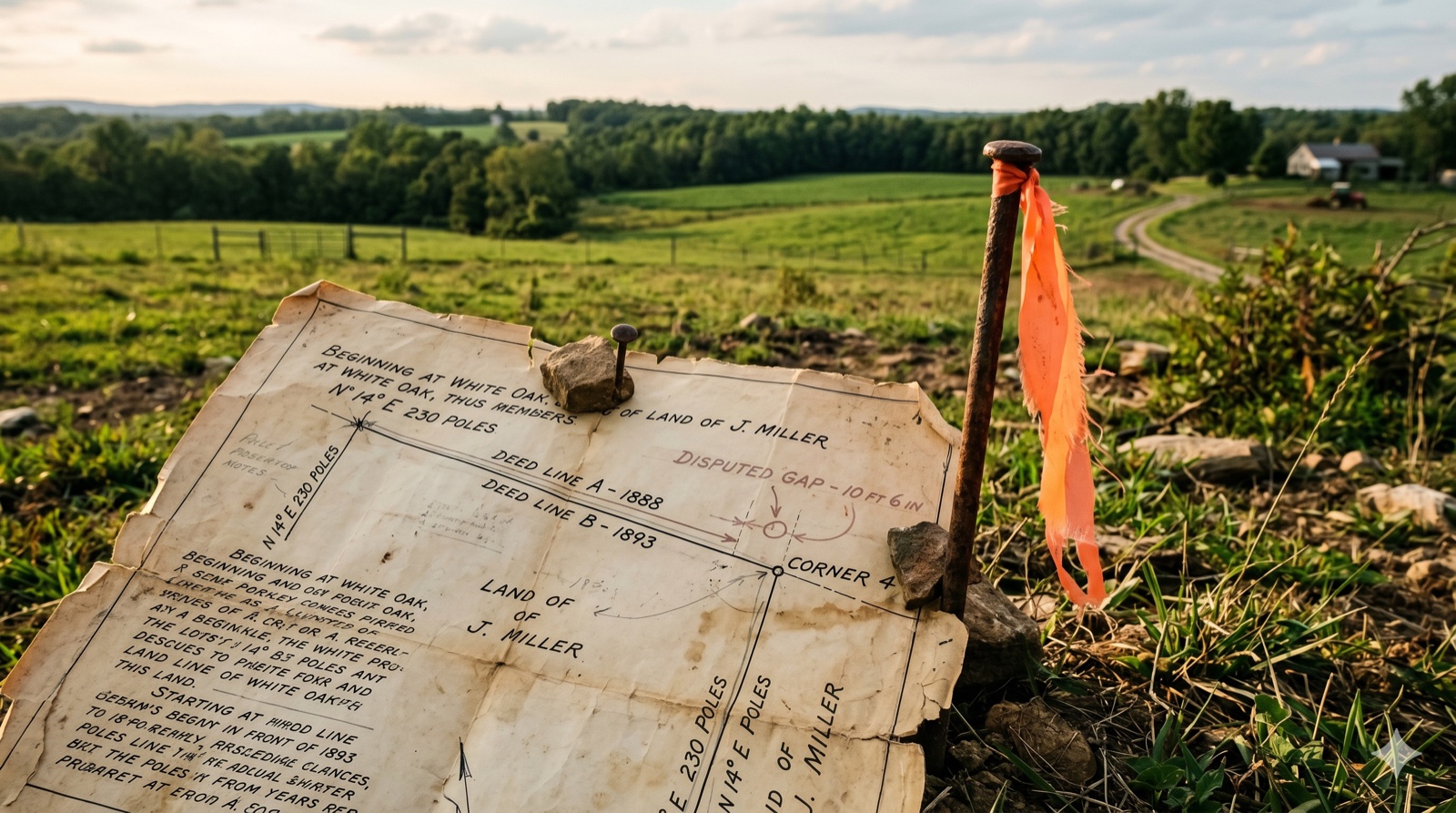
My Farm's Boundary Is a River or Creek That Has Moved — Do I Still Own the Ground It Left Behind?
Key Takeaways
- Gradual movement shifts your legal boundary with the water; sudden movement doesn't. Under the doctrines of accretion, erosion, and reliction, a boundary "follows the varying course of the stream," but if the channel suddenly relocates by avulsion, "the resulting change of channel works no change of boundary, which remains in the middle of the old channel" — the rule the U.S. Supreme Court applied to a Mississippi River state line in Arkansas v. Tennessee, 246 U.S. 158 (1918), and state courts have applied the same way to private riparian land.
- This is a water-boundary-law question, not a records error or a neighbor fight. It's a different problem than a deed/tax/survey acreage mismatch (three sources measuring the same fixed tract differently) and different again from a boundary dispute with a neighbor (a disagreement over where an unmoving line runs) — here, the line itself may have moved under the law, or may not have, depending on how the water moved.
- Whether the channel is legally "navigable" changes who owns the bed, and that changes the analysis. On navigable rivers the state generally holds title to the streambed under the equal-footing doctrine, while on non-navigable streams state law commonly runs the private boundary to the center, or "thread," of the channel — Georgia's code (O.C.G.A. § 44-8-2) is one example of a state that spells this out explicitly.
My Farm's Boundary Is a River or Creek That Has Moved — Do I Still Own the Ground It Left Behind?
When a river or creek that forms part of your legal boundary moves gradually — through accretion or erosion — most states shift your boundary right along with it; when it moves suddenly, typically in a flood, that's avulsion, and the boundary stays fixed at the center of the old channel no matter where the water runs today. Which one happened to your parcel determines whether the ground the water left behind, or the ground it swallowed, is still legally yours.
This is a genuinely different question than the two most similar-sounding situations we cover elsewhere. It isn't a deed, tax, and survey acreage mismatch, where three administrative sources disagree about the acreage inside a boundary that hasn't itself moved. And it isn't a boundary dispute or encroachment, where two neighbors argue over where a fixed line sits. Here, the water itself is part of the legal description, the channel has physically relocated, and state common law — not a survey crew — decides whether your boundary moved with it. A fresh survey will tell you exactly where the creek runs today. It will not, on its own, tell you whether today's water line is your legal line.
The rest of this guide walks through the four doctrines that control this question, how courts and states decide which one applies, why navigability changes the analysis, and what to actually do before you list or sell. For related situations, see our guides on selling farmland generally and selling land in a flood zone, or visit the Jerez Land blog for more.
What's the Difference Between Accretion, Erosion, Reliction, and Avulsion?
Accretion is gradual soil buildup on your bank, erosion is gradual soil loss from it, reliction is dry land permanently exposed by a receding waterline, and avulsion is a sudden channel relocation, usually from a flood — the first three quietly shift your legal boundary with the water, while avulsion freezes the boundary at the old channel, according to Cornell Law School's Legal Information Institute.
Cornell's Wex legal encyclopedia defines accretion (sometimes called alluvion) as the gradual addition of soil, sand, and other earth to land bordering water, and states plainly that "any addition to one's property by accretion becomes that person's legal property." Erosion is the mirror image — the slow, imperceptible wearing away of a bank by water — and under the same doctrine, an owner who loses ground this way loses legal title to it along with the soil. Reliction is a related but distinct process: it's what happens when water permanently recedes — a channel narrows, a lake shrinks, a water table drops — leaving dry land where water used to be; Cornell defines it as "the increase in land caused by the gradual recession, shrinkage, or change in course of a body of water," and notes the key qualifier: the adjacent owner only gains title if the recession is permanent, not a seasonal low-water event.
Avulsion breaks the pattern entirely. Cornell defines it as water "quickly submerging land or moving land to another location," and the defining legal consequence is that "the original owner retains ownership of land displaced by avulsion" — the change is real and often dramatic on the ground, but it does not, by itself, move the legal boundary.
| Process | What Physically Happens | Speed | Where Your Legal Boundary Ends Up | What You Need to Do Before Selling |
|---|---|---|---|---|
| Accretion | Soil and sediment build up gradually against your bank, adding dry land | Gradual, imperceptible day to day | Boundary moves outward with the new water line — the added ground is legally yours | Document the gain as gradual (historical aerials help), get a current survey tied to today's water line |
| Erosion | The river or creek gradually wears away your bank, carrying soil downstream | Gradual, imperceptible day to day | Boundary moves inward with the retreating water line — you lose the eroded ground | Same evidence trail as accretion; a current survey documents what remains under your deed |
| Reliction | Water permanently recedes (a channel narrows, a water table drops), exposing former streambed | Gradual, and must be shown to be permanent | Boundary moves to the new, lower water line, but only once the recession is proven permanent | Distinguish a genuinely permanent recession from a seasonal low-water period, with imagery over multiple years |
| Avulsion | The channel suddenly relocates, typically in a single flood event | Sudden, perceptible while it's happening | Boundary stays fixed at the center of the OLD channel, regardless of where the water runs today | Locate the old channel's historical centerline (old surveys, aerials, flood records) — that, not today's water, is often still your legal line |
Does My Farm's Boundary Move With the River, or Stay Fixed at the Old Channel?
Your boundary moves with the river if the channel shifted gradually through accretion, erosion, or reliction, and stays fixed at the center of the old channel if the shift was a sudden avulsion — a rule the U.S. Supreme Court traced through more than a century of its own decisions and applied to a state boundary along the Mississippi River, and that state courts have applied the same way to private farmland.
In Arkansas v. Tennessee, 246 U.S. 158 (1918), the Court was asked to fix the Arkansas–Tennessee line after the Mississippi River suddenly cut a new channel — the "Centennial Cut-off" — in 1876. The opinion states the rule directly: "when the bed and channel are changed by the natural and gradual processes known as erosion and accretion, the boundary follows the varying course of the stream; while if the stream from any cause, natural or artificial, suddenly leaves its old bed and forms a new one, by the process known as an avulsion, the resulting change of channel works no change of boundary, which remains in the middle of the old channel." The Court also noted this is the same rule applied "as between private proprietors" — it isn't a special interstate-boundary rule, it's the general common-law rule that states also apply between neighboring landowners.
State courts in our footprint have applied it directly to private, farm-adjacent land. In Oklahoma's Goins v. Merryman, 183 Okla. 155, 80 P.2d 268 (1938), two owners along a bend of a river in LeFlore County disputed whether newly dry ground belonged to the accretion-claiming owner or was the product of a sudden avulsive shift; the court held that "if the bed of a river changes by accretion, the boundary line bordering upon the river changes with it, but if the change is by avulsion, the boundary line remains as it was originally" — and set out the evidentiary test: the question isn't whether change happened over time, it's "whether they could perceive the change while it was going on." A shift you can watch happen, even slowly over a season, points toward accretion or erosion; a shift no one saw occur — discovered only after the fact — points toward avulsion. North Carolina's leading case on the doctrine, State v. Johnson, 278 N.C. 126, 179 S.E.2d 371 (1971), reaches the same result even though it arose from a shifting tidal inlet rather than a farm creek: the court held an island owner gains land by accretion the same as a mainland owner, but that once a boundary had become fixed at an ascertainable line, the further movement of an avulsive inlet had no effect on it.
Does It Matter Whether My River or Creek Is Legally "Navigable"?
Yes — navigability changes who owns the streambed itself, not whether the accretion/avulsion rule applies: on a navigable river the state generally holds title to the bed and your riparian line typically runs only to the ordinary high-water mark, while on a non-navigable stream state law commonly places the private boundary at the center, or "thread," of the channel, and that thread is what moves (or doesn't) under the doctrines above.
Under the "equal footing doctrine," each state received title to the beds of waters that were navigable — usable for trade and travel — at the time it joined the Union, a principle Cornell's Constitution Annotated traces through the U.S. Supreme Court's public-lands jurisprudence. If your creek or river segment counts as navigable under your state's test, you generally don't own the streambed at all; your riparian rights and your boundary run to the water's edge, and the accretion/avulsion doctrine still governs whether that edge — and your land alongside it — has moved. Most farm creeks and small rivers, by contrast, are non-navigable, and in that case the private landowner's boundary typically extends to the center of the current. Georgia's code makes this explicit for non-navigable streams: each owner's boundary "shall extend to the thread or the center of the main current of the water," that line "follows the current" as it changes gradually, but "if for any cause the stream takes a new channel, the original line, if capable of identification, remains the boundary" — accretion and avulsion, in statutory form, applied to the thread rather than the bank.
The practical stakes are real. If your creek is non-navigable and gradually migrated 60 feet across your bottomland over twenty years, your boundary likely migrated with it under most states' law — you may have gained or lost farmable ground without anyone filing a new deed. If the same creek jumped 60 feet in a single flood, your boundary is probably still where the old channel ran, meaning the ground on "your" side of today's water may not legally be yours, or vice versa. Because this varies by doctrine, by state, and by the specific facts of your channel's history, we've verified the general rule and its application to Oklahoma, North Carolina, and (via statute) Georgia concretely above; for Alabama, Michigan, Mississippi, Pennsylvania, South Carolina, and Tennessee, the same common-law framework applies in principle, but the exact case law, statutory language, and any local wrinkles need to be confirmed with a real estate attorney licensed in that state before you rely on it.
Is This the Same Problem as an Acreage Mismatch or a Neighbor Boundary Dispute?
No — a shifted river or creek boundary is a distinct legal question from both situations it can resemble on the surface: a deed/tax/survey acreage mismatch is a records-and-measurement discrepancy about a tract whose boundary hasn't moved, and a boundary dispute is a disagreement between neighbors over where a fixed, non-water line actually runs.
Our guide on deed, tax, and survey acreage mismatches covers a parcel where the boundary itself is stable — the deed's calls, a current survey, and the county's tax or GIS acreage simply disagree about how many acres that stable boundary encloses, because they were measured by different methods at different times for different purposes. Nothing about the line has physically moved; three sources are just describing it differently. Our guide on boundary disputes and encroachments covers the opposite kind of stability problem — a fixed line that two neighbors disagree about, often because a fence, driveway, or decades of use doesn't match the paper description. Again, nothing about the boundary has physically moved; people disagree about where it always was.
A shifted river or creek boundary is neither. The physical channel — the very feature your legal description uses to mark the line — has actually relocated, and the question is a substantive one of water-boundary law: did that relocation carry your legal boundary with it, or did the law leave your boundary behind at the old channel? No amount of re-measuring today's ground resolves that question, because the answer turns on how the channel moved (gradually or suddenly) and on which state's accretion/avulsion doctrine applies — information a standard boundary survey typically doesn't capture on its own.
What Do I Actually Need to Do Before I Sell Farmland With a Shifted River Boundary?
You need more than an ordinary boundary survey — a surveyor can plot exactly where the water runs today and where your deed's calls fall, but only a review of how and when the channel moved, plus your state's accretion/avulsion law, tells you which line is actually your legal boundary, and that determination typically needs a real estate attorney, not just a field crew.
In practice, that means a few concrete steps. First, build a record of the channel's movement over time: historical aerial imagery (many county GIS sites and the USDA's Farm Service Agency archives carry decades of coverage), old plats or surveys, and — if a specific flood or storm is the suspected cause — local flood records or news coverage tied to a date. That record is what lets anyone, including a court, distinguish a gradual accretion/erosion pattern from a sudden avulsive jump, using the same "could you watch it happen" test Oklahoma's courts apply. Second, get a current survey, but treat it as step two, not step one — it documents today's physical reality, not the legal history that determines which reality controls. Third, loop in a real estate attorney licensed in the state where the land sits before you finalize a sale; the accretion/avulsion rule is common law that varies by state, and only local counsel can confirm how your state's courts would characterize your specific channel's history. Fourth, disclose what you know and don't know rather than guessing — tell a buyer the boundary is water-based, that the channel has moved, and what evidence you have (or don't) about how.
None of that has to be fully resolved before you can sell. If you'd rather not carry a shifted-water-boundary parcel through a lender's underwriting — which will often want the accretion/avulsion question answered before closing — request a no-obligation cash offer and we'll work from your deed, the water history you have, and whatever survey exists, rather than requiring the boundary question to be legally settled first. For more on selling land with title, boundary, or legal-description complications, visit the Jerez Land blog.
Frequently Asked Questions
My deed says the creek is my east line, but the creek has moved into my neighbor's field over the last 50 years — do I still own that farmed ground, or does he?
It depends entirely on how the creek moved, which you can't answer from the deed alone. If the shift happened gradually over those 50 years — the kind of change you could have watched happen season by season — most states' accretion doctrine moves your legal boundary with the creek, meaning your neighbor may now own the ground the creek left behind on the old side, or you may own new ground on the other side, depending on which way it drifted. If instead the creek jumped suddenly in one event, like a major flood, avulsion doctrine generally freezes the boundary at the old channel regardless of where the water runs today. You'll need historical aerial imagery or old surveys to show which pattern actually happened before anyone can say who owns the ground.
We had a flood two years ago that cut a brand-new channel across our bottomland, and the old channel is now a dry ditch — is our boundary the new water or the old one?
Under the avulsion doctrine that most states apply, your boundary is very likely still the center of the OLD channel — the dry ditch — not the new water, because a sudden channel relocation from a single flood event doesn't move a legal boundary the way gradual erosion or accretion does. Cornell Law School's Legal Information Institute and case law in states like Oklahoma both describe this as the default rule: the original owner keeps what avulsion displaced, and the boundary stays fixed at the old channel's location even though water no longer runs through it. Confirm this against your specific state's case law before relying on it, since the doctrine is common law that varies by state.
I'm getting ready to sell and my survey just plots the creek where it runs today — does that mean the surveyor already resolved the accretion/avulsion question for me?
No. A standard boundary survey documents where the water physically sits right now and ties that to your deed's written calls, but it doesn't independently determine whether your legal boundary moved with the water under accretion doctrine or stayed fixed at an old channel under avulsion doctrine — that's a legal conclusion about how and when the channel moved, not a field measurement. If your deed's boundary is described by reference to a river or creek and that watercourse has visibly shifted, ask your surveyor directly whether the plat reflects today's water line, the old channel, or both, and treat the accretion/avulsion question as a separate step that likely needs a real estate attorney's review of the channel's history.
How do courts tell the difference between gradual erosion and a sudden avulsion when the change happened over a period of years?
Courts generally look at whether the change was perceptible while it was happening, not just whether it happened over time — Oklahoma's Supreme Court, in a case about a shifting river bend, framed the test as "whether they could perceive the change while it was going on," rather than whether witnesses could later see that progress had been made. A gradual erosion or accretion pattern is one you (or a neighbor) could have watched unfold season by season, even if slowly; an avulsion is a change that occurred abruptly enough that no one witnessed it happening in real time, even if its full effects only became clear afterward. Historical aerial imagery, old surveys, and flood or storm records are the usual evidence used to make that call.
Does it matter whether the river or creek on my property is considered "navigable" under state law?
Yes, navigability changes who owns the streambed itself, which changes where your boundary line runs. On a legally navigable river, the state generally holds title to the bed under what's called the equal-footing doctrine, and a private riparian owner's boundary typically runs only to the water's edge or ordinary high-water mark. On a non-navigable stream — which covers most small farm creeks and rivers — state law commonly places the private landowner's boundary at the center, or "thread," of the channel, as Georgia's code spells out explicitly for non-navigable streams. Either way, the accretion/avulsion rules above still determine whether that boundary line has moved; navigability determines where the line sits in relation to the water in the first place.
Can I still sell farmland if the exact acreage on each side of a moved river or creek hasn't been legally sorted out?
Yes. An unresolved accretion/avulsion question doesn't make farmland unsellable, but it does mean a retail buyer's lender will often want the boundary question answered — with a survey, a title opinion, or an attorney's review of the channel's history — before they'll close, which can slow a listing considerably. A direct cash buyer can work from your deed, whatever survey and imagery history exists, and honest disclosure of what you know and don't know about how the channel moved, without requiring the legal question to be fully settled first. Whichever path you choose, disclose the water-boundary situation plainly rather than assuming today's channel is automatically your line.
Disclaimer: This article is for informational purposes only and does not constitute legal, financial, or professional advice. Laws and regulations vary by jurisdiction and change over time. Always consult a licensed real estate attorney familiar with your state's water-boundary law, and a licensed surveyor, before making decisions about a shifted river or creek boundary, relying on a survey, or closing a property transaction affected by an accretion, erosion, reliction, or avulsion question. Jerez Land is not responsible for actions taken based on this information.