
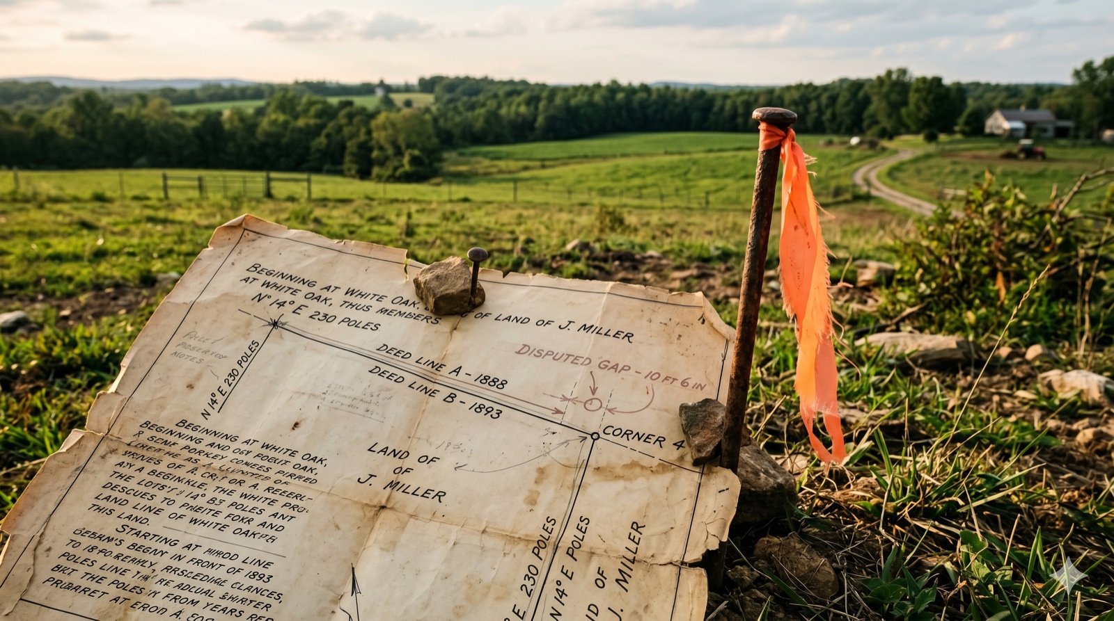
My Deed, Tax Assessor, and Survey All Show Different Acreage — Which Number Is Real?
Key Takeaways
- The three numbers answer three different questions, not one. A current boundary survey governs where your lines actually run on the ground; your deed's written description governs what you legally own; and the county tax assessor's or GIS acreage is an administrative estimate that controls neither — a distinction confirmed by the UNC School of Government's explanation of "deeded, calculated, and assessed" acreage as three separate attributes counties track.
- Acreage is the weakest call in a deed, by design. Under the standard rules of construction surveyors and courts use to resolve conflicting deed language, natural and artificial monuments control first, courses and distances control second, and a stated quantity like "40 acres" controls last — meaning the acreage figure in your deed was never meant to be the precise, controlling measurement in the first place.
- A modest mismatch usually isn't a legal problem; a gross one can be. Courts generally treat land sold "more or less" as a sale in gross, where ordinary acreage variance gives no remedy — but Tennessee's Supreme Court found fraud in Vaughn v. Ray when a deed calling for "25 acres more or less" turned out, on survey, to be a 45% shortfall.
My Deed, Tax Assessor, and Survey All Show Different Acreage — Which Number Is Real?
None of the three numbers is "wrong" in the way that word usually implies — they're answering different questions. Your recorded deed's description, run through its boundary calls, controls what you legally own. A current boundary survey controls where those boundaries actually sit on the ground today. The county tax assessor's or GIS acreage is neither of those things — it's an administrative estimate built for billing and mapping, and it legally controls nothing about your title or your boundary lines.
That resolution matters because sellers often assume the discrepancy itself is the problem — that something is broken, missing, or in dispute. Usually nothing is. This is a different situation than an overlapping or gap legal description, where two recorded deeds genuinely conflict about where a boundary line runs — that's a real title defect that needs a curative document. What you're looking at is three sources measuring or estimating the same tract by three different methods, at three different points in time, for three different purposes. It's also a narrower question than the general "do I need a survey to sell land" decision — you're not starting from scratch on whether to survey; you're staring at three specific numbers that already disagree and trying to figure out what they mean.
The rest of this guide walks through why each number exists, why they diverge, whether the mismatch is a title problem (usually not), whether you need to order a new survey (not always), and what you actually owe a buyer in terms of disclosure. If you're gathering the rest of your closing documents at the same time, our guide on the paperwork typically needed to sell land covers what else a title company will want to see. For more situations like this, visit the Jerez Land blog.
Which Acreage Number Actually Controls — My Deed, My Tax Bill, or a Survey?
Legally, your deed's written boundary description controls what you own, and a current survey controls where that description sits on the ground — the tax assessor's and GIS acreage figures control neither, because they're administrative estimates, not legal instruments. When a deed's boundary calls conflict with its own stated acreage, the boundary calls win; the acreage figure is treated as the least reliable piece of information in the description.
This is a real, well-established rule of construction, not just a rule of thumb. When a deed's description contains internal conflicts, surveyors and courts resolve them using a standard order of priority: natural monuments (rivers, ridgelines) rank highest, artificial monuments (iron pins, marked corners) next, then courses and distances, then adjoining boundary lines — and a stated quantity of land, like "containing 40 acres," ranks lowest of all. If a deed calls for a line running "200 feet to an iron pipe" and the pipe is actually found 210 feet away, the pipe controls and the 200-foot figure is disregarded. The same logic applies to acreage: if the boundary lines described in the deed enclose 38 acres but the deed also says "containing 40 acres, more or less," the lines control and the 40-acre figure yields.
The phrase "more or less" (sometimes written "M.O.L.") is doing real legal work when it appears after an acreage figure. Courts generally treat a sale described that way as a sale in gross — a sale of the tract as bounded, not a sale priced or guaranteed by the acre — which means the stated quantity is understood by both parties to be an approximation. Under that doctrine, an ordinary variance between the stated acreage and the actual acreage gives a buyer no legal remedy at all; a sale by the acre, where the parties actually price and contract per acre, is treated differently and a smaller disparity can justify relief. The line between "ordinary variance" and something a court will act on is really about size: Tennessee's Supreme Court, in Vaughn v. Ray, found fraud where a deed described "25 acres more or less" but a survey turned up only 13.63 acres — a shortfall of more than 45% — combined with evidence the seller already knew the county tax rolls listed a smaller figure. A small gap between your deed's stated acreage and a new survey's number, by contrast, is exactly the kind of everyday variance the "more or less" language exists to absorb.
Why Doesn't the County Tax Assessor's or GIS Acreage Match My Deed?
County tax and GIS acreage is a mapping and billing estimate — built from tax maps, aerial imagery, and digitized deed descriptions — that is explicitly not a survey and is not represented as one, which is why it routinely differs from both your deed's stated acreage and a professional survey's measured acreage. Assessors' offices even track this as three separate, named figures rather than pretending one number serves every purpose.
The UNC School of Government's local government blog lays this out plainly for tax administrators: parcel records commonly carry deeded acreage (copied from the recorded deed), calculated acreage (measured off the county's GIS parcel layer), and assessed acreage (the figure the tax office actually bills against) — and the guide notes that "assessed acreage" is the one used for tax purposes, which is not automatically either of the other two. Counties commonly reconcile these using a tolerance range rather than a hard rule — swapping in the calculated figure only when it diverges from the deeded figure by a set percentage that shrinks as parcel size grows. That reconciliation process is itself an admission that the two numbers are expected to diverge somewhat as a matter of course.
Two mechanical reasons make the gap wider than sellers expect. First, GIS parcel layers are digitized representations, not field measurements, and every county that publishes one says so directly. Polk County, North Carolina's mapping site carries the warning "THIS IS NOT A SURVEY," disclaiming any warranty on the accuracy of the boundaries shown and noting the data is provided "as is." That's standard language across county GIS sites in general — the map is a reference tool built for tax administration and public lookup, not a legal boundary determination. Second, deeded and calculated acreage can differ simply because they measure different things: a deed's stated acreage sometimes includes land now occupied by a road right-of-way, an easement, or water that the assessor's calculated figure excludes (or vice versa), because the two figures were compiled for different purposes at different times.
None of this means the tax or GIS number is useless — it's often a reasonable ballpark, and it's the number your tax bill is actually based on. It just isn't the number a title company, a court, or a buyer's attorney treats as controlling.
Why Would an Old Survey and a New Survey of the Same Land Disagree?
An old survey and a new survey of the same tract can produce different acreage even when both surveyors did competent work, because a resurvey's job is to retrace the original surveyor's footsteps rather than to independently remeasure the land from scratch — and the tools, reference points, and even magnetic north available to the original surveyor may have shifted substantially since. Retracement is a documented profession-wide principle, not a shortcut: under the doctrine that governs how boundaries are re-established, "the corners of the original survey are unchangeable," and a retracing surveyor's role is to locate where the original monuments and lines actually were, not to correct or improve on them.
Several concrete, verifiable reasons drive real-world divergence between an old survey and a new one:
- Instrumentation changed. Older metes-and-bounds surveys, especially pre-1970s ones, were often run with a magnetic compass and a chain — tools far less precise than the total stations and GPS equipment modern surveyors use, which measure distance and angle electronically and aren't affected by magnetic interference.
- Magnetic north moved. A deed's bearings recorded from a compass reading decades ago reflect the magnetic declination of that specific place and year. Declination shifts measurably over time — the U.S. Geological Survey tracks and publishes exactly how much it changes at a given location — so a bearing that was accurate when the original survey was run can be off by a meaningful angle today if it's misread as a fixed compass direction rather than retraced from the original monuments.
- The starting point moved or was rebuilt. If the original survey started from a monument that has since been destroyed, moved, or was itself imprecisely placed, a modern surveyor has to reconstruct that starting point from the best available evidence (old plats, adjoiner deeds, physical remnants) rather than simply re-measuring from a convenient nearby point — and small differences in where that starting point is placed propagate through the whole boundary.
- Right-of-way was taken since the original description was written. Road widening or a recorded easement can shave real acreage off a tract after the original deed was written, without anyone re-recording a new legal description to reflect it.
- PLSS aliquot descriptions were never exactly 40 acres to begin with. If your parcel is described by a fraction of a section — "the NE 1/4 of the SW 1/4 of Section 12" — that description is nominal, not measured. The federal rectangular survey system's own manual explains that meridian convergence, closing errors, and irregular fractional sections along township boundaries mean quarter-quarter sections routinely measure more or less than the theoretical 40 acres, and the original surveyor's field measurements — not a clean arithmetic assumption — control the actual boundary.
Georgia's parcels carry a related but different wrinkle. Rather than the federal township-and-range grid used across most of the country, much of Georgia was originally distributed through a land lottery system run between 1805 and 1833, which divided the state into districts and land lots ranging from 40 to 490 acres depending on the specific lottery. Those district and lot boundaries — laid out once, roughly two centuries ago — are still the legal basis for land lot descriptions in much of the state today, which is its own source of old-survey-versus-new-survey divergence distinct from the PLSS convergence issue.
Which Survey System Governs Your State — and Why It Matters for the Mismatch
The nine states Jerez Land buys in split cleanly between two different original survey traditions, and knowing which one applies to your land explains a lot about why your numbers look the way they do. Alabama, Michigan, Mississippi, and Oklahoma were surveyed under the federal Public Land Survey System — the township-range-section grid that produces aliquot descriptions like quarter-quarter sections. Georgia, North Carolina, Pennsylvania, South Carolina, and Tennessee are metes-and-bounds states that never adopted the PLSS grid; Georgia's land-lot-and-district system is its own historical variant within that group, while North Carolina, South Carolina, Pennsylvania, and Tennessee rely on the older tradition of describing boundaries by monuments, courses, and distances rather than a section grid. If your deed reads like fractions of a section, you're in PLSS territory and the "nominal versus actual" gap described above is your likely explanation. If it reads as a chain of bearings and distances tied to trees, pins, and adjoiner calls, the compass-versus-GPS and footsteps-of-the-original-surveyor issues are more likely what you're seeing.
| Acreage Source | What It Is | What It Legally Controls | Typical Accuracy | Who to Contact to Question It |
|---|---|---|---|---|
| Recorded deed description | The boundary calls (and often a stated acreage) filed in the county land records when the property last transferred | What you legally own — the boundary calls control over any stated quantity | As accurate as the underlying survey it was drawn from, which for older deeds may be decades old | County register of deeds / recorder of deeds, or a title company pulling the chain of title |
| County tax assessor record | The acreage figure the county bills property tax against | Nothing about title or boundaries — governs only the tax bill itself | Often copied from the deed or a prior assessment; may not reflect current conditions | County tax assessor's or property appraiser's office |
| County GIS parcel layer | A digitized map built from tax maps, aerial imagery, and deed descriptions for reference and mapping | Nothing legally — nearly every county GIS site explicitly disclaims that it is not a survey | Varies widely by county; explicitly not survey-grade | County GIS/mapping department |
| Current boundary survey | A licensed surveyor's field measurement and retracement of the actual boundary on the ground | Where the boundary lines actually run, once accepted and (if applicable) recorded | The most accurate of the four when performed by a licensed surveyor retracing the original evidence | A licensed land surveyor in the state where the land sits |
Is an Acreage Mismatch a Title Problem, and Do I Need a New Survey Before I Sell?
An acreage mismatch between your deed, tax record, and any survey is usually not a title defect, because standard title insurance already anticipates it — an owner's title policy insures your title to the land as described, not the exact quantity of acres within it, and acreage or survey-related matters typically sit inside the policy's survey exception rather than being insured outright. That's a different situation from a genuine boundary conflict, where two recorded instruments actually disagree about where a line runs.
Because owner's title policies generally don't insure the number of acres a tract contains, a shortage-in-area problem isn't something a title company will typically flag as a defect to be cured before closing — it's simply outside what the policy promises in the first place. If a buyer or their lender wants that risk covered, some underwriters offer an additional "shortages in area" endorsement for an added premium, tied to a current survey, but that's a coverage choice a buyer makes, not evidence that your title itself is clouded. Compare that to selling land with a lien or cloud on title, where the underlying problem is a competing claim or unresolved encumbrance on the record — a category error to lump an acreage estimate into.
You don't automatically need a new survey to sell land with an acreage mismatch. It's worth ordering one when: the gap between your numbers is large rather than a rounding-level variance; you or a buyer want to price the deal per acre rather than in gross (see below); a buyer's lender or title underwriter specifically requires a current survey as a condition of financing or issuing an endorsement; you're planning to split off or sell part of the tract, where selling part of your land makes an accurate current boundary essential rather than optional; or there's an actual boundary question — an encroaching fence, a disputed corner, or a neighbor's competing claim — as opposed to just three numbers that don't match. If none of those apply and the discrepancy is modest, disclosing all three figures honestly is often enough to move a sale forward without the cost and time of a new survey.
What Are My Options for Selling Land With a Deed, Tax, and Survey Acreage Mismatch?
Selling land with an acreage mismatch comes down to three broad paths — listing with a land broker, selling directly to a neighbor or adjoining owner, or selling to a direct cash buyer — and the mismatch itself rarely rules any of them out, since the underlying fix in every case is the same: disclose all three numbers honestly rather than picking the most flattering one.
Listing with a land broker puts your parcel in front of the widest buyer pool, but a broker will typically want the acreage question addressed up front, because a retail buyer's lender may require a current survey before closing and a stalled financing contingency over an acreage question can cost you weeks of marketing time. Selling directly to a neighbor or adjoining owner sidesteps some of that friction — a neighbor already has boundary context and may be less concerned with the exact acreage than with the specific line they share with you — but it's a narrow buyer pool that only exists if an adjoining owner happens to want more land right now. Selling to a direct cash buyer removes the financing contingency and the lender-driven survey requirement entirely, since a firm, individually priced written offer isn't waiting on a bank's underwriting requirements — though a serious buyer will still want the deed's description and any survey history disclosed accurately before making that offer.
Whichever path you choose, the practical rule is the same: give a buyer the deed's stated acreage (with its "more or less" language, if it has one), the tax/GIS figure, and any survey figure you have, and identify the source of each rather than presenting one as a settled fact. If you'd rather skip the listing-and-showing process altogether, request a no-obligation cash offer and we'll work from the deed and whatever survey history exists rather than needing the acreage question fully resolved before we can talk numbers. For more on selling land with title or boundary complications, visit the Jerez Land blog.
Frequently Asked Questions
My deed says 40 acres more or less, my tax bill says 38.2 acres, and I don't have a survey yet — which number do I use to price and advertise the land?
Use the deed's figure, and carry its "more or less" qualifier when you disclose it, since that's the number tied to your actual legal ownership. Don't advertise the tax assessor's number as if it were more authoritative — it's an administrative estimate, not a measured figure, and it can run higher or lower than what you actually own. The safest approach is to disclose both numbers plainly, note that you don't have a current survey, and let a serious buyer decide whether ordering one before closing matters to them.
Does a survey showing fewer acres than my deed states mean I actually lost land?
Not necessarily. A new survey often reveals that the deed's stated acreage was always an estimate — sometimes based on an older, less precise survey, sometimes affected by later right-of-way takings, and sometimes just imprecise from the start. Under the rules courts and surveyors use to interpret deeds, the boundary lines control over the stated quantity, so if a new survey retraces those same lines and finds less acreage, it's typically correcting an old estimate rather than reflecting land you actually lost. A large, unexplained shortfall is worth discussing with a surveyor or real estate attorney rather than assuming either explanation by default.
We're worried the acreage mismatch means there's a cloud on our title — should we get a title attorney involved before we list the land?
Usually the mismatch alone isn't a title defect — standard owner's title insurance insures your title to the land as described, not the exact acreage, so a discrepancy between your deed, tax record, and a survey doesn't typically create the kind of competing claim that clouds title. It becomes worth involving an attorney if the discrepancy traces back to an actual boundary conflict, such as an overlapping description with a neighboring deed, rather than just three sources measuring or estimating the same tract differently. If you're not sure which situation you're in, a title company's preliminary search can usually tell you quickly.
My property tax bill lists more acreage than my deed does — could I be overpaying property tax because of this?
Possibly, and it's worth checking. Counties generally track deeded, calculated, and assessed acreage as separate figures, and the assessed figure — the one your tax bill is actually based on — doesn't always match your deed. If you believe your parcel is overstated on the tax roll, contact your county assessor's office directly; many will correct a clear clerical error informally, and if not, the county board of equalization is the standard channel for a formal assessment appeal in the states Jerez Land operates in. Bring your deed and, if you have one, a current survey as supporting evidence.
Our deed describes the land as "the NE 1/4 of the SW 1/4 of Section 12" — will that ever match the acreage the tax office has on file exactly?
Not reliably, and that's normal for land described this way. Quarter-quarter section descriptions under the federal rectangular survey system are nominal — a theoretical 40 acres — but the original government survey lines that actually define your boundary rarely enclose exactly that figure, because of meridian convergence, closing errors, and irregular fractional sections built into the original survey grid. The acreage that actually controls is whatever the original survey lines enclose on the ground, not the round number implied by the fraction in your legal description.
Does a buyer's lender or title company have the right to require a new survey before closing if the acreage numbers don't match?
Yes, a buyer's lender or the title company issuing their policy can make a current survey a condition of closing, particularly if the buyer wants "shortages in area" coverage added to their title policy or if the deal is priced per acre rather than in gross. Whether you or the buyer pays for it is a matter of your purchase contract, not a fixed rule — some contracts assign the cost to the buyer, some to the seller, and some split it, so if you expect this to come up, it's worth addressing survey cost and a "subject to survey" price-adjustment clause in the contract before you're negotiating it mid-transaction.
Disclaimer: This article is for informational purposes only and does not constitute legal, financial, or professional advice. Laws and regulations vary by jurisdiction and change over time. Always consult a licensed real estate attorney or licensed surveyor before making decisions about an acreage discrepancy, ordering or relying on a survey, or closing a property transaction affected by a boundary or acreage question. Jerez Land is not responsible for actions taken based on this information.